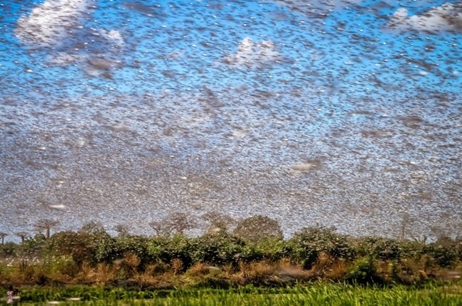
South Africa is banking on a tracking technology backed by the institute of Microsoft’s late co-founder, Paul Allen to tackle the infestation, bracing for a repeat of last season’s locust swarms which was the worst in decades,
According to Jason Kümm, manager of rural safety and communications at the Agri Eastern Cape organization which represents farmers in the coastal province, started using the Allen Institute for AI’s Earth Ranger system in April to pinpoint where swarms will erupt in September and October,
“Things are quietening down but these locusts have laid eggs,” he said in an interview. “Earth Ranger has allowed us to understand where this has taken place when conditions are right and these eggs hatch, we will have the resources in place.”
Swarms that spread across the Eastern Cape and neighboring provinces in the summer growing season were as big as 10,000 hectares in some cases and the infestation rivaled those seen in 1935 and 1983.
ALSO READ: Government intervenes on petrol price in South Africa: Petrol Hike
The locusts razed pastures used to feed livestock across large parts of the region, including in areas that were recovering from eight-year droughts.
The heaviest rains since records began in 1921 in many districts allowed the insects to multiply rapidly while citrus-growing areas were infested, the locusts didn’t cause significant damage to fruit trees.
The area is also home to dairy farms, sheep and angora goats whose hair is used in mohair garments.
“This is one of the biggest we have experienced in history,” said Gunther Pretorius, manager for economics and natural resources at Agri Eastern Cape.
With Earth ranger, farmers are allowed to call in reports of swarms, whether the locusts are at a juvenile hopping stage or already airborne. Those are then logged and tracked on the system, allowing for more efficient allocation of pesticides and resources. They can also decide whether ground teams or aircraft are needed to tackle the insects.
The tracking system was developed in 2015, offered as a free service and was first used to measure the size of Africa’s savanna elephant population by assessing data from aerial surveys.
