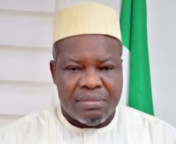
The Surveyor General of the Federation, Mr. Abuduganiyu Adebomehin, has said that the Federal Government’s plan to map Nigeria is fully on course, stressing that those threatening to challenge the movement of the Office of the Surveyor General of the Federation (OSGOF) to the Presidency are only questioning a presidential order.
Mr. Adebomehin made this known while receiving members of the Nigerian Institution of Surveyors (NIS), Abuja branch, during a courtesy visit to his office.
He explained that President Bola Ahmed Tinubu’s administration had shown strong interest in the national mapping project after he was briefed that the last comprehensive mapping of Nigeria was conducted in the 1970s. According to him, the Renewed Hope Agenda has placed surveying at the centre of national development, and the OSGOF is now better positioned to play a critical role.
“His Excellency President Bola Tinubu was very interested after he was briefed by OSGOF that the last time Nigeria was mapped was in the 70s. I don’t know why some people are threatening to go to court over this decision. This is the first time we would be having real surveying in Nigeria under the Renewed Hope Agenda of Mr President; no one can challenge the presidential order,” he said.
The Surveyor General added that his office had already embarked on key collaborations with other ministries to advance infrastructure projects. He revealed that OSGOF worked with the Minister of Works, Mr. David Umahi, during a tour of the coastal bridge project. According to him, the Federal Government plans to construct a tunnel from Victoria Island to Badagry in Lagos State, which he noted would be the first of its kind in Africa.
Mr. Adebomehin further explained that moving OSGOF to the Presidency was necessary to harness the full potential of the office. He said the agency had long operated with a limited budget and was slowed down by bureaucratic processes that hampered decision-making.
“My aim is to give the surveying profession ample opportunity to develop. It is much better for OSGOF to be under the Presidency to harness its potential. The office has been working with a low budget and is slow in decision-making because of the bureaucracy,” he stated.
Also speaking, the Head of Hydrography in OSGOF, Mr. Robert Coker, said anyone opposing the transfer of OSGOF to the Presidency must understand that it was a directive from the highest authority in the country.
“Anyone that is not happy with the movement of OSGOF to the Presidency amounts to fighting the presidential order, and they have to contend with the highest authority in the land,” he said.
He also urged members of the Nigerian Institution of Surveyors and other professionals in the field to protect the integrity of the profession by mentoring young surveyors and promoting ethical standards.
On his part, the Secretary of the Nigerian Institution of Surveyors, FCT branch, Mr. Alfred Adeojo, commended the boldness of the Surveyor General in achieving the movement of the office to the Presidency. He said the decision would bring new opportunities for the profession and help create a stronger platform for upcoming surveyors.
“With the movement of OSGOF to the Presidency, it means good things are ahead. It took the Surveyor General a lot of courage and boldness to achieve this, and we, the young ones coming behind him, shall emulate this,” Adeojo said.
Stakeholders at the meeting agreed that placing OSGOF directly under the Presidency will give the office the authority and resources needed to carry out large-scale projects such as mapping, hydrography, and geospatial data management. They said these services are critical for national planning, infrastructure development, and disaster management.
The mapping project is expected to improve planning across key sectors, including housing, transportation, agriculture, and environmental management. Analysts also note that accurate maps and geospatial data are vital for security operations, urban development, and economic planning, making the renewed focus on surveying an important milestone in Nigeria’s development agenda.
